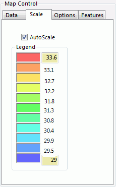
GIS - Map Control Scale


The Refresh button on the Data tab must be clicked to apply any changes.

  • AutoScale – Enable AutoScale to set the Legend boundaries based on the highest and lowest data value in the system. Only generators are shown.

  • Legend – Shows the data values corresponding to the colors on the GIS map. The highest and lowest values may be modified to adjust the scale.


GIS - Map Controls

The GIS Map Controls box is used to control mapping features and update data graphics. The Map Controls box has four (4) tabs to adjust various settings.

Data

Scale

Options

Features


 GIS

 GIS - Map Control Scale


For further assistance, please contact Aurora Support.

Copyright© 1997-2025 Energy Exemplar LLC. All rights reserved.